MyCoast Pilot Project Webinar: April Showers Bring...MyCoast!

When: 1 p.m. April 22
What: Annual recap, update on municipal activities and next steps for coastal Connecticut
Why participate?
- Learn about MyCoast pilot project activities from the past year and highlights from Stonington, Groton, and New London.
- Discuss how MyCoast photos can be used to inform flood planning.
- Share thoughts with other local professionals on the topic of coastal flooding.
- Learn about next steps and planning for continued MyCoast funding.
 MyCoast App, contact information
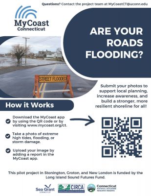
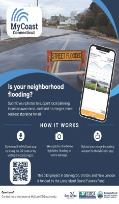
- To download the MyCoast App and start taking photos in New London, Groton, and Stonington please visit THIS PAGE (https://mycoast.org/ct)
- Instructions for downloading & using the MyCoast app.
- For questions and more information, please email MyCoastCT@uconn.edu
MyCoast in the News
"MyCoast CT: tapping communities to verify need for resilience project," story can be found here.
Read about the CT MyCoast project in a story that ran in The Westerly Sun on Dec. 3, 2025.
See the WFSB Channel 3 Eyewitness News story from Aug. 18, 2025 here.
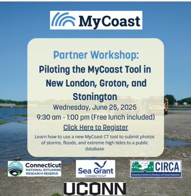
Join the MyCoast pilot project in New London, Groton & Stonington
 Connecticut Sea Grant (CTSG), the Connecticut National Estuarine Research Reserve (CT NERR) and the Connecticut Institute for Resilience and Climate Adaptation (CIRCA) have partnered together to implement MyCoast as a pilot project in New London, Groton and Stonington.
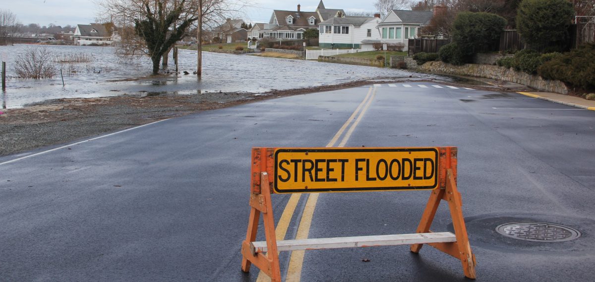
MyCoast is a tool for reporting coastal events such as storms, floods, and extreme high tides. To participate, download the MyCoast app for Apple iOS devices, or for Android devices, then make an account and upload images of these events to the Connecticut database. Help us catalogue flooding in these three southeast Connecticut communities and start conversations about the areas that you’re most concerned about. The goal is for your photos to help with local resilience planning and storm preparedness.
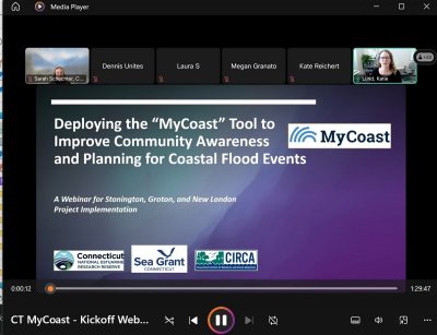 Recording of April 10, 2025 MyCoast webinar:
Click here to find a recording of the webinar "Deploying the MyCoast Monitoring Tool to Improve Community Awareness
and Planning for Coastal Flood Events–A Webinar for Stonington, Groton, and New London Project Implementation."
Slides from the MyCoast webinar can be found by clicking here.