Story and photos by Judy Benson
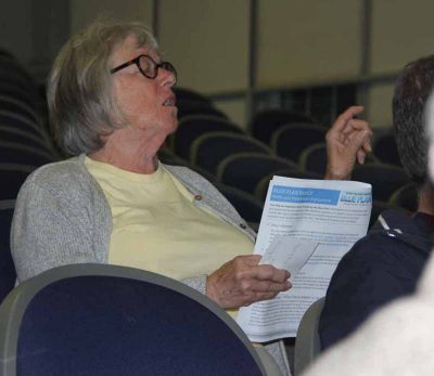
Groton – Commercial clammer Rosemary Louden asked how the Long Island Sound Blue Plan would impact the business that’s been in her husband Jay’s family for the past 100 years.
At the May 14 public meeting on the plan, she learned that the historic Louden commercial shellfish beds in Greenwich are considered “significant human use areas” that would gain protection from any proposals that would impact them. The meeting took place at UConn’s Avery Point campus, the third in a series of six along the Connecticut coast.
“The Blue Plan is for new uses,” said Sylvain De Guise, director of Connecticut Sea Grant and one of the leaders of the four-year project to write the plan, the state’s first comprehensive marine spatial map, guide and use inventory for the estuary. “If you’re clamming there now, your right to clam should be established and documented.”
In the plan, areas identified as “significant human use areas” and “ecologically significant areas” are designated as places where any new activity that adversely impacts them should be avoided.
Louden’s question was one of several posed during the meeting, which took place during the 90-day public comment period on the draft version of the plan. After the comment period ends June 21, it will be revised into a final version and submitted to the Environment Committee of the state Legislature. The committee would decide whether to forward it to the full General Assembly for approval or send it back for further revisions.
The meeting began with an overview of the plan by Christian Fox, Blue Plan outreach coordinator. The inventories of human uses – from commercial fishing to shipping to sailing and many others – and significant ecological areas – from eelgrass beds to hard bottom and complex seafloor areas — provide the foundation for understanding which areas should be preserved from development plans that could impact them. By identifying and mapping these areas, regulators and developers will both have the information they need to ensure minimal harm to them.

“The Blue Plan will help everyone make better decisions about what happens in Long Island Sound,” Fox said. “It will help reduce conflicts. The take-home point is that the Blue Plan identified and protects areas we care about.”
Inviting questions from the audience, Fox emphasized that public input will make the Blue Plan better.
“We want to hear from you,” he said. “Does this make sense? Tell us what you know and what you think. Help us to improve this plan.”
In answer to one question about how the plan would be kept current, Fox explained that it must be updated at least every five years, and that a public hearing would take place annually to receive input. In addition, new information could be added as it becomes available, he said.
Jane Clukay of Groton asked what role the Blue Plan would play if an offshore wind farm sought to lay a transmission cable in the Sound.
“The Blue Plan allows for developers to have more information up front to identify the least impactful

areas as they look at different routes,” said Brian Thompson, director of the Land and Water Resources Division for the state Department of Energy and Environmental Protection, the lead agency with Sea Grant and the Connecticut Chapter of the Nature Conservancy in creation of the plan.
Clukay replied that having the Blue Plan would be beneficial for the Sound’s future.
“I think it’s great to identify these areas up front,” she said.
Additional public meetings will take place at 6:30 p.m. on May 23 at the Pavilion at Saybrook Point, 155 College St., Old Saybrook; at 7 p.m. on May 29 at Town Hall Auditorium, 110 Myrtle Ave., Westport; and at 7 p.m. on June 5 at City Hall Auditorium, 110 River St., Milford.
The Blue Plan can be accessed by clicking here.